Our LRDAS (Long-Range Detection and Assessment System) Coverage Studies are designed to secure large-scale and high-risk areas with precision and reliability. We evaluate and optimize detection system performance to ensure accurate threat identification and rapid response—across distances ranging from hundreds of meters to several kilometers.
LRDAS solutions play a vital role in early detection of intrusions, unauthorized access, and potential threats, making them ideal for protecting remote sites, critical infrastructure, and high-value assets.
- Our Services Include:
- Site-Specific Threat & Terrain Analysis
We assess site geography, layout, and risk levels to define optimal detection zones and select the most suitable technologies. - Sensor Placement & Coverage Optimization
Using advanced simulation tools, we design strategic sensor layouts with proper overlap to eliminate blind spots and ensure continuous detection coverage. - Technology Assessment
We evaluate and recommend the appropriate combination of technologies—such as radar, thermal imaging, infrared (IR) barriers, LiDAR, and PTZ tracking systems—based on environmental and operational requirements. - Environmental Impact Evaluation
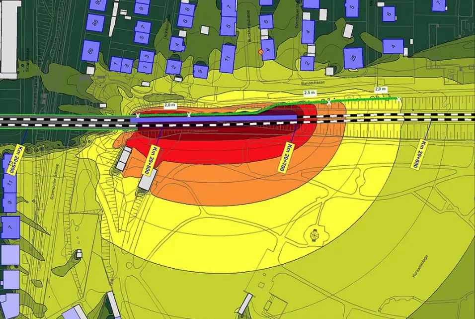
Our studies consider real-world conditions including terrain variations, vegetation, dust, heat, wind, and lighting to ensure reliable detection performance while minimizing false alarms. - Coverage Visualization (Detection Maps)
We provide detailed coverage maps illustrating detection ranges, sensor zones, overlap areas, and potential gaps for clear understanding and decision-making. - System Integration Planning
We offer recommendations for seamless integration with existing systems, including CCTV, access control, and centralized command and control platforms.